El Hamool (Al Ḩāmūl)
El Hamool or (الحامول) is one of the largest cities in the Kafr El Sheikh Governorate, in the north of Egypt. It is located in the northern part of the Governorate.
The name, El Hamool, comes from the name of a plant known locally as "el hamool" which is usually planted in Lake Burullus near Baltim.
The name, El Hamool, comes from the name of a plant known locally as "el hamool" which is usually planted in Lake Burullus near Baltim.
Map - El Hamool (Al Ḩāmūl)
Map


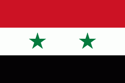
Country - United_Arab_Republic
 |
 |
| Flag of Egypt | |
The republic was led by Egyptian President Gamal Abdel Nasser. The UAR was a member of the United Arab States, a loose confederation with the Mutawakkilite Kingdom of Yemen, which was dissolved in 1961.
Currency / Language
| ISO | Currency | Symbol | Significant figures |
|---|---|---|---|
| EGP | Egyptian pound | £ or جم | 2 |
| ISO | Language |
|---|---|
| AR | Arabic language |
| EN | English language |
| FR | French language |